


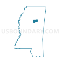
Walthall Voting District, Webster County, Mississippi
About
Outline

Summary
| Unique Area Identifier | 606928 |
| Name | Walthall Voting District |
| County | Webster County |
| State | Mississippi |
| Area (square miles) | 13.30 |
| Land Area (square miles) | 13.15 |
| Water Area (square miles) | 0.15 |
| % of Land Area | 98.89 |
| % of Water Area | 1.11 |
| Latitude of the Internal Point | 33.60354890 |
| Longtitude of the Internal Point | -89.27907740 |
Maps


Graphs
Select a template below for downloading or customizing gragh for Walthall Voting District, Webster County, Mississippi


Neighbors
Neighoring Voting District (by Name) Neighboring Voting District on the Map
- Bellefontaine Voting District, Webster County, MS
- Bluff Springs Voting District, Webster County, MS
- Eupora 1 Voting District, Webster County, MS
- Eupora 2 Voting District, Webster County, MS
- Fame Voting District, Webster County, MS
Top 10 Neighboring County Subdivision (by Population) Neighboring County Subdivision on the Map
- District 5, Webster County, MS (2,188)
- District 2, Webster County, MS (1,997)
- District 1, Webster County, MS (1,837)